
Day Hikes in Sedona, AZ
- Rebecca Shugart

- May 15, 2022
- 3 min read
Updated: May 21, 2022
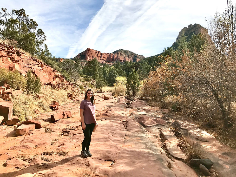
For this East Coast girl, Arizona was like a whole other planet! I lived for the desert landscape, red rock formations, wild cacti, and dry weather. We planned our trip in November of 2017 and it ended up being the perfect time to go because it wasn't too hot during the day for hiking and I barely sweat on any of the hikes! That's almost unheard of in muggy Georgia!

Arizona Road Trip Schedule
First we decided to start our Arizona road trip in Phoenix and planned to end in Page, AZ.
Our chosen route:
Phoenix -> Sedona -> pit stop in Grand Canyon (South Rim) -> Page, AZ
Upon arriving, we rented a car & spent the night in Phoenix and got up early to head to our AirBnB in Sedona.
Sedona is about 2 hours North of Phoenix, traveling up I-17.
We had two of the best day hikes in Sedona planned:
-Devil's Bridge Trail
-Little Horse Trail to Chicken Point + Bell Rock Loop.
-While there we ended up adding on a short hike up Doe Mountain Trail which was totally worth it!

Devil's Bridge Trail
Length: 3.9 miles - takes about 1.75 hours to complete Elevation Gain: 521 ft Route Type: Out & Back

Devil's Bridge is the largest natural sandstone arch located in Sedona, AZ. This hike gives you a great opportunity to get out in the desert landscape and take in views of Red Rock State park and Coconino National Forest. This is one of the most Instagrammable spots in Sedona! People at the top were generous and kind at helping each other get great shots and taking turns out on the bridge.


The hike is relatively easy the whole way except for the end as you approach the natural stone staircase where it gets pretty steep. Make sure to really pay attention to trail markings. Because of the sparse vegetation sometimes pathways between brush look like a trail, but it's not! We got a little lost for a bit and had to find our way back to the Pink Jeep Trail. This is where apps like the All Trails App are super helpful in keeping you safe and on track! View the All Trails Guide to Devil's Bridge Here!


Doe Mountain Trail
Length: 1.5 miles - took about 45 mins to complete Elevation Gain : 511 ft Route Type: Out & Back

After hiking Devil's Bridge Trail we had time for another short hike. We looked around the area and found Doe Mountain Trail in Red Rock State Park.
The parking was very close to the trailhead. We did this is late afternoon, but I think this would be a great spot for a sunrise or sunset hike!
This is a very doable trail for people of all ages. The trail consists of a lot of switchbacks which look out over the State Park and it was so pretty!
View the All Trails Guide to Doe Mountain Trail Here!


Once you reach the top of the mesa, and go through some brush, you reach the edge for a 360 view around Sedona. It was absolutely breathtaking! I could have stay up there for hours. This was such a nice surprise to us and I would highly recommend adding this to your Sedona Hiking Itinerary if you're planning a trip to Arizona!


Little Horse Trail; Courthouse Butte and Bell Rock Loop Length: 3.6 miles; 3.9 miles Elevation Gain : not sure; 357 ft Route Type: Out & Back; Loop
This was our last planned hike for our time in Sedona. Chicken Point has some great views and lookouts. It was fun adventuring around climbing on some of the red rock formations. When we made it back to the Bell Rock Pathway we decided to go around a portion of the loop. By the end we really felt like we had gotten a great look at everything around and were ready to start our trek up to Page, Arizona.
View the All Trails App. Guide to Little Horse Trail Here View the All Trails App Guide to Courthouse Butte and Bell Rock Loop Here


Comments